 | |  |
|
 |
  
 
Experts /
Social /
Photos /
News /
Jobs /
Articles /
LBS /
Contact /
Advertising
This newsletter is online
HERE
- Previous Edition
- Facebook

Intergraph Offers $500 Savings for CAU2014@HxGN LIVE Early Registration
| | |
Hello GISuser... and welcome to another Thursday news roundup from the GISuser community. To begin, imagine mashing up some of your favorite things... well, that's what this cool effort from MIT is doing and it really is awesome! Yes indeed, I take notice when I see maps of things I really enjoy, like beer and coffee! Enter these maps showing "walkable regions" for independent coffee shops in major Metropolitan areas like Brooklyn, Portland, and Seattle. For these maps, the researchers used the Google Places API and the Google Distance Matrix" - the maps were developed by a social computing group at MIT as part of the You Are Here Project - be sure to read all about it here. Coffee always makes me think of the PacNW and perhaps the lead story is a good reminder for those of us contemplating heading to FOSS4G this September in Portland, OR. FOSS4G, to be held September 8th-13th in Portland, Oregon, USA is the premier international conference on open source geospatial technologies - See more HERE. Finally, here's details of an awesome opportunity in the form of the Climate Resiliance App Challenge. This contest challenges all developers to create an app using the Esri ArcGIS Platform to help communities, see, understand, and prepare for climate risks. The deadline to enter is June 2 ( More Details HERE).
Have a great day all!
Comments or Tips? Please Contact Us
|
 |
 |
 | | |
 |
Sponsored by Avenza Systems
Geographic Imager® transforms Adobe® Photoshop® into a powerful geospatial image editor. Work with satellite imagery, aerial photography, elevation data, and orthophotos in GeoTIFF and other GIS image formats using native Adobe Photoshop tools. Maintain georeferencing and support for hundreds of coordinate systems, projections, and transformations.
Visit www.avenza.com for more information.
|
| |
 |
 |  |
|
 Mashing up Two of My Favorite Things. Coffee + Maps for Coffee walkingshed communities - Independent coffee shops are positive markers of a living community. They function as social spaces, urban offices, and places to see the world go by. Communities are often formed by having spaces in which people can have casual interactions, and local and walkable coffee shops create those conditions, not only in the coffee shop themselves, but on the sidewalks around them. This effort from MIT maps independent coffee houses and defines walkinshed communities from them.
Keep Track of Wildfires with the Esri Public Information Map - Sadly, another violent wildfire season may be upon us as intense weather systems and tinder dry conditions meetup. A reminder from Esri this week came my way in the form of the Esri Wildfire Public Information Map. About the service... View an interactive map of US wildfire locations, perimeters, fire potential areas, global burn areas, wind conditions, and precipitation via streaming data from NIFC, GeoMAC, NHSS, MODIS, METAR/TAF, and the USDA Forest Service, Fire Modeling Institute.
Esri Opens Its Storytelling with Maps Contest - All entries must make use of one of Esri's Story Maps apps. Your Story Maps may be hosted anywhere, including by Esri, but the code for each entry needs to have originated with one of Esri's Story Maps apps. Contest participants may-and in fact are encouraged to-alter or customize the Story Maps app to suit their needs. One grand prize will be awarded to the best overall Story Maps entry chosen by the contest judges.

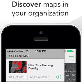 Explorer for ArcGIS Brings GIS to Everyone - With Explorer for ArcGIS, users can access any of their organization's maps authored in ArcGIS Online or Portal for ArcGIS. Users are able to search for information about their assets, determine where their assets are in relation to their current location, and share that information easily. The app allows users to share maps several ways including e-mail, text message, and platform-specific methods such as AirDrop (for iOS).
GeoTech Newsmakers
Got news... Send your news to

More Tech News!
LBSZONE.com |
SymbianOne |
Amerisurv.com |
LidarNews.com |
3DMachineControl
|
|
|
|
| | |
 | Sponsored by Trimble
Be ready for anything with the Trimbler Geo 7 series. No matter what gets in your way Geo 7X handhelds offer two powerful technology innovations so you stay productive when the going gets tough. Trimble FloodlightT technology keeps you working when heavy overhead cover obstructs weak satellite signals. When occupying the position is not possible, turn to Trimble WavepointT technology to capture offset measurements and still get the position, despite dangerous conditions or right-of-way challenges-saving time each day while getting previously impossible work done.
To learn more trimble.com/geo7.
|
| | |
|
| |
|
|

Each day in this section we'll update you about Geospatial conferences, training, seminars,
webinars, and relevant events. Feel free to make a suggestion for future consideration and be sure to see our Events Calendar.
 FME International User Conference 2014 -
Join us in Vancouver between June 10-13, 2014 for the FME International User Conference. Find new ideas and best practices with courses, presentations, and networking opportunities at the world's largest FME event. June 10-13, 2014, Vancouver BC.
FME International User Conference 2014 -
Join us in Vancouver between June 10-13, 2014 for the FME International User Conference. Find new ideas and best practices with courses, presentations, and networking opportunities at the world's largest FME event. June 10-13, 2014, Vancouver BC.
FOSS4G PDX 2014 -
FOSS4G, to be held September 8th-13th in Portland, Oregon, USA is the premier international conference on open source geospatial technologies. With two days of workshops followed by three days of presentations and academic papers, FOSS4G features a diversity of attendees and participants spanning academia, industry, and government.
HxGN Live -
You'll see technology previews, meet Intergraph experts, and enjoy great entertainment. You'll also hear an inspiring keynote by Steven Cost, our new Intergraph Security, Government & Infrastructure (SG&I) president. Find out about the great things SG&I is doing in your industry. MGM Grand, Las Vegas, June 2-5, 2014
Let GISuser help promote your next event or webinar!
Contact us
|
|
|
|
| | |
 | Sponsored by the University of Denver
The University of Denver's college of professional and continuing studies, University College, and the Department of Geography are partnering to offer a Master of Science in Geographic Information Science delivered online for working adults. This online Master's Degree in Geographic Information Sciences recognizes the emerging importance of geographic information science and the importance of integrating advanced study in geographic information systems, remote sensing, and global positioning systems with traditional studies in human, cultural, and physical geography.
Learn more about the University of Denver's Master of Science in Geographic Information Science
|
| | |
|
| |

GeoJobsBIZ from Spatial Media - Our fabulous, new resource for GIS, geo technology, surveying, mapping and positioning career opportunities and resumes. Check it out at Geojobs.Biz.
GIS Python Developer - Experience with creating software deployment packages using InnoIDE, WiX, or equivalent that supports Microsoft Windows platforms and software/ESRI toolboxes developed via Python. This includes experience in developing deployments using Python modules such as multiprocessor and pyQt.
GIS Technician, Erie PA - Regional multi-disciplinary firm is accepting resumes for a GIS Technicians for our Erie, PA office. Proficiency with ESRI ArcGIS Desktop required. Bachelor's degree in GIS, Geography, Computer Science or other degree with extensive GIS course work required. Salary based on qualifications.
Systems Project Analyst -
Creates and distributes GIS products to Soldiers and installation staff. Coordinates with the Sustainable Range Program (SRP) GIS Users Working Group (UWG) on management requirements for SRP GIS. Supports ITAM's Sustainable Range Awareness component through production of educational materials.

Post your job online with GeoJobsBIZ and you'll also get attention via the GISuser LinkedIn Group, FB Page, and Twitter!
(To list your HOT Job for some added exposure and support our efforts, contact jobs at
gisuser.com - List your Career opportunity online for 60 days and right here in the newsletter)
Send your job ad to jobs[at]gisuser.com
<< Go To The career center >>

Glenn maintains a fun, educational, and informative tech blog
AnyGeo - Anything geospatial. Look for tips, tricks, and commentary about GIS, Geo, mobile, social, and basically, anything geospatial!
|
| | | | |
 | Sponsored by Exelis
ENVI LiDAR geospatial software allows you to create powerful, realistic 3D visualizations and easily extract features of interest from LiDAR data. The New ENVI LiDAR API allows you to control, extend, and automate your feature extraction and data processing, giving you the power to easily create situational awareness and understanding from your LiDAR data. Discover the next dimension of your data!
|
| | | | |
|
Did-U-Know you can connect with more than 35,000+ other GIS professionals via LinkedIn via our popular GIS Professionals Group - Also, connect with 2500 others via the GISuser facebook page.
 Dive Into Python-Free 328 Page eBook - Whether you're an experienced programmer looking to get into Python or grizzled Python veteran who remembers the days when you had to import the string module, Dive Into Python is your 'desert island' Python book.
 Create an Interactive Map with jQuery (Video) -
jQuery is a popular technology tool with the map geeks these days. Here's a training resource that might help you to get up and running with jQuery - enjoy! In Create an Interactive Map with jQuery, Chris Converse shows how to design and create a rich interactive map for a web site, working in a coding environment and using the open-source scripting library jQuery.
Create an Interactive Map with jQuery (Video) -
jQuery is a popular technology tool with the map geeks these days. Here's a training resource that might help you to get up and running with jQuery - enjoy! In Create an Interactive Map with jQuery, Chris Converse shows how to design and create a rich interactive map for a web site, working in a coding environment and using the open-source scripting library jQuery.
Delivering Enterprise Information Securely on Android, Apple iOS and Microsoft Windows Tablets and Smartphones - This paper describes these issues and explains how they can be addressed effectively with Citrix BYOD solutions.
Android, iOS and Windows tablets and smartphones play an increasing role in enterprise computing, providing new flexibility and mobility for workers and IT-but creating new challenges around security.

ADVERTISE with Spatial Media LLCSpatial Media LLC GISuser.com Media Kit - our Media kit with rates and ad options is now available for those
interested in reaching customers via GISuser.com,LBSzone.com, SymbianOne.com, Amerisurv.com, and The American Surveyor Magazine. Interested in reaching a large, targeted audience of geospatial technology end-users, LBS professionals, technology managers, and key decision makers? Don't forget to start planning your 2014 ad placement and promotions with GISuser now!
Contact us for
more details and sponsorship information for online banner ads, newsletter sponsorship, and email list
rentals.
| | | | | |  | |  |
|
