| |  |
|
 |
  
 
Experts /
Social /
Photos /
News /
Jobs /
Articles /
LBS /
Contact /
Advertising
This newsletter is online
HERE
- Previous Edition
- Facebook

LiDAR webinar today! Making Money with the Speed of Light, 1 - 2:15 PM EDT
| | |
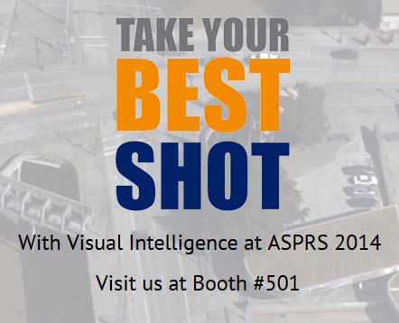
Hello GISuser... and welcome to our Tuesday GeoTech news roundup. No doubt some of you are in Kentucky this week to take in the annual ASPRS event - enjoy the show and be sure to say hi to our gang if you see them on the floor! A few companies sharing news from ASPRS this wek include Visual Intelligence who are showing off their new digital aerial sensor - The iOne M+T Medium Format Digital Aerial Sensor. Our friends from Lizardtech are also at ASPRS showing attendees Express Server 9 software, which launched recently. Attendees can also get a look at their LiDAR Compressor software as well. We've all been bombarded with constant news updates and reports about the search for the missing Malaysian airliner. Yesterday, exactEarth shared details that an Australian ship is close to retrieving debris believed to be from the plane (still speculation on the origin of the debris at this time). The company has also released detailed Tracking Data of the Search for MH370. A recently updated view from exactEarth's constellation of satellites which are tracking the world's shipping, shows all ships in the area and clearly shows the remoteness of the region.
Finally, how would you like to win a trip for 2 to Florida to experience zero gravity like a real-life astronaut? Well, that's exactly what Nokia is offering up to developers that submit a windows 8 app created using the Nokia Imaging SDK 1.1, Deadlines are coming up soon! Details HERE
Comments or Tips? Please Contact Us
|
 |
 |
 | | |
 |
Sponsored by Avenza Systems
Geographic Imager® transforms Adobe® Photoshop® into a powerful geospatial image editor. Work with satellite imagery, aerial photography, elevation data, and orthophotos in GeoTIFF and other GIS image formats using native Adobe Photoshop tools. Maintain georeferencing and support for hundreds of coordinate systems, projections, and transformations.
Visit www.avenza.com for more information.
|
| |
 |
 |  |
|
 WEBINAR - Making Money with the Speed of Light
3D technologies present a huge blue ocean of opportunity. Sit in with LIDAR News Editor Dr. Gene Roe and Ken Smerz, CEO of Eco3D to discuss the ever-evolving business of 3D imaging services. Stick around for an interactive Q&A session at closing. tHE WEBINAR TAKES PLACES TODAY AT 1 pm EDT.
 Technology Leaders Commit to Climate Data Initiative and Challenge Developers - March 19 was all about climate and climate change! A high profile event took place in D.C. yesterday to formally launch the Climate Data Initiative, an ambitious new effort bringing together extensive open government data and design competitions with commitments from the private and philanthropic sectors to develop data-driven planning and resilience tools for local communities. Tech leaders from Esri, Google, Intel, NOAA, NASA and other orgs were on hand to offer their commitment to the effort.
 The World's Most Ethical Companies Are Ranked for 2014
What do Dell, Intel, Microsoft, and Google have in common? Yes indeed, they all made the list of the most ethical companies! The World's Most Ethical (WME) Companies designation recognizes companies that truly go beyond making statements about doing business "ethically" and translate those words into action.
|

Each day in this section we'll update you about Geospatial conferences, training, seminars,
webinars, and relevant events. Feel free to make a suggestion for future consideration and be sure to see our Events Calendar.
 FOSS4G PDX 2014 -
FOSS4G, to be held September 8th-13th in Portland, Oregon, USA is the premier international conference on open source geospatial technologies. With two days of workshops followed by three days of presentations and academic papers, FOSS4G features a diversity of attendees and participants spanning academia, industry, and government.
FOSS4G PDX 2014 -
FOSS4G, to be held September 8th-13th in Portland, Oregon, USA is the premier international conference on open source geospatial technologies. With two days of workshops followed by three days of presentations and academic papers, FOSS4G features a diversity of attendees and participants spanning academia, industry, and government.
HxGN Live -
You'll see technology previews, meet Intergraph experts, and enjoy great entertainment. You'll also hear an inspiring keynote by Steven Cost, our new Intergraph Security, Government & Infrastructure (SG&I) president. Find out about the great things SG&I is doing in your industry. MGM Grand, Las Vegas, June 2-5, 2014
Geoint Symposium 2014 -
The GEOINT 2013* Symposium takes place April 14-17, 2014 at the Tampa Convention Center in Tampa, Florida. The GEOINT Symposium is the preeminent event of the year for the defense, intelligence and homeland security communities.
More Event News and Tips
Let GISuser help promote your next event or webinar! Contact us
|
|
|
|
| | |
 |
Sponsored by The GEOINT Symposium
The annual GEOINT Symposium is the nation's largest intelligence event. GEOINT 2013* will be held in Tampa, FL, April 14-17. Don't miss a full day of science and technology discourse, three days of keynote addresses and panel discussions, more than 30 hours of training and education sessions, and 250+ exhibits.
|
| | |
|
| |

GeoJobsBIZ from Spatial Media - Our fabulous, new resource for GIS, geo technology, surveying, mapping and positioning career opportunities and resumes. Check it out at Geojobs.Biz.
 Geodesign Practice Manager
 - Provide vision and leadership in coordinating and promoting the use of Esri technology for land based planning and design projects among top principal architects and engineers at leading firms.
Geodesign provides a design framework and supporting technology for professionals to leverage geographic information, resulting in designs that more closely follow natural systems.
.NET Developer, UK -
Our client is a global company offering a diverse, performance-driven culture and an innovative and engaging environment. They are launching a new initiative and are in need of 2-3 software engineers to join their team. They are working with 1 - 4 million lines of code and need developers that are energized by that rather than scared away!
Location Analytics Product Engineer - Are you a highly skilled individual who has what it takes to drive quality and participate in the the release of sophisticated location analytics technology? Join the team responsible for releasing a software system that runs on browsers, mobile devices, enterprise class servers, and in the cloud.
GIS Analyst - With limited direction, develop and maintain Geographic Information Systems related to stormwater functions. This will include stormwater infrastructure mapping, easement mapping, hydrology and hydraulics modeling utilizing GIS. This position will also coordinate and work with the County IT/GIS Department to develop and maintain critical datasets.
Post your job online with GeoJobsBIZ and you'll also get attention via the GISuser LinkedIn Group, FB Page, and Twitter!
(To list your HOT Job for some added exposure and support our efforts, contact jobs at
gisuser.com - List your Career opportunity online for 60 days and right here in the newsletter)
Send your job ad to jobs[at]gisuser.com
<< Go To The career center >>

Glenn maintains a fun, educational, and informative tech blog
AnyGeo - Anything geospatial. Look for tips, tricks, and commentary about GIS, Geo, mobile, social, and basically, anything geospatial!
|
| | | | |
 | Sponsored by Exelis
ENVI LiDAR geospatial software allows you to create powerful, realistic 3D visualizations and easily extract features of interest from LiDAR data. The New ENVI LiDAR API allows you to control, extend, and automate your feature extraction and data processing, giving you the power to easily create situational awareness and understanding from your LiDAR data. Discover the next dimension of your data!
|
| | | | |
|
Did-U-Know you can connect with more than 35,000+ other GIS professionals via LinkedIn via our popular GIS Professionals Group - Also, connect with 2500 others via the GISuser facebook page.
 Dive Into Python-Free 328 Page eBook - Whether you're an experienced programmer looking to get into Python or grizzled Python veteran who remembers the days when you had to import the string module, Dive Into Python is your 'desert island' Python book.
GPS Tracking of Company Vehicles: The Complete Reference Guide - GPS vehicle tracking has gained popularity in many segments of the business world. Two main reasons account for this increase in popularity: a maturing technology with falling prices, and the desire for increased employee productivity.
Building a Smarter IT Infrastructure for Local Government - More and more local governments' web-based services are available every year. While convenient for users, it's on your shoulders to seamlessly meet your organization's increased application delivery demands. In fact, local government's success in providing online programs depends on your ability to ensure that users always have fast and secure access to online applications.

ADVERTISE with Spatial Media LLCSpatial Media LLC GISuser.com Media Kit - our Media kit with rates and ad options is now available for those
interested in reaching customers via GISuser.com,LBSzone.com, SymbianOne.com, Amerisurv.com, and The American Surveyor Magazine. Interested in reaching a large, targeted audience of geospatial technology end-users, LBS professionals, technology managers, and key decision makers? Don't forget to start planning your 2014 ad placement and promotions with GISuser now!
Contact us for
more details and sponsorship information for online banner ads, newsletter sponsorship, and email list
rentals.
| | | | | |  | |  |
|