| |
 |
|
SimActive Correlator3DT Chosen by ING Robotic Aviation for Image Post-Processing
Along with using SimActive's software for internal post-processing requirements, ING Robotic Aviation is recommending it as the de-facto software with their robotic aircraft systems. They join Correlator3DT users across the globe using the software's capability to process thousands of images, at unparalleled speed and quality.
|
|
| |
 |
|
Prepare for Holiday Travel with Interactive Esri Maps for Severe Weather
Just in time for the holiday travel season, Esri has released a pair of interactive maps that can help you navigate treacherous weather and find anything you've lost along the way. Both of these maps are available for the media to embed or share as part of holiday travel and weather coverage. |
|
| |
 |
|
Using Lidar to Classify Landslides
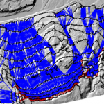
A new algorithm for automated landslide inventorying, named the Contour Connection Method (CCM), has been developed that relies on simplified morphological features for analysis. Previous landslide mapping techniques have included field inventorying, photogrammetry, and use of bare-earth (BE) lidar Digital Elevation Models (DEMs) to highlight regions of instability. |
|
| |
 |
|
iphone infographic
Infographic - The History of the iPhone
While Apple certainly wasn't the only company to come up with the idea of a smartphone, it would be difficult to argue that Apple's fingerprints aren't all over today's smartphones thanks to the iPhone. Take a look at the numbers behind Apple's smartphone revolution and what the future might for the device. |
|
|
|







