GISuser Home GISuser Today
SEP 12, 2019
HIRE A GIS PRO
GISuser
Sponsor


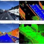
GISuser Road-SIT Survey v. 7.5: The features that streamline the survey work
SITECO Infomatica SRL will be attending Intergeo 2019 in Stuttgart, Hall 3, Stand B3.025, showcasing the Road-Scanner family of Mobile Mapping Systems and the NEW software release of Road-SIT Survey.
GISuser DJI and Delair partner to improve efficiency of commercial drone use
The partnership will include an agreement for Delair to sell DJI products through its worldwide sales channel, along with launching a relationship to build compatibility across platforms.
gisuser news Maxar Satellite Imagery shows Golden Ray Carrier Ship Capsizing
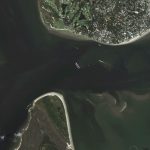
Maxar’s WorldView-2 satellite collected a new image (September 10th) of the Golden Ray—the car carrier ship that capsized on Sunday in the middle of Saint Simons Sound, near Brunswick, Georgia. The ship was reportedly carrying thousands of vehicles and overturned early on Sunday morning after departing from the nearby port of Brunswick.
here Virtual Surveyor to Unveil Enhanced Cut-and-Fill Mapping in Drone Surveying Package at InterGEO 2019
Virtual Surveyor has added cut-and-fill mapping capabilities to Version 7.0 of its popular drone surveying package. The new functionality enables users to quickly perform volume difference calculations and generate cut-and-fill maps from drone images captured on two or more different dates.
GISuser Select and download sections of large point clouds right in your browser with NavVis IndoorViewer 2.5
The upcoming release of NavVis IndoorViewer 3D building visualization software will include a new feature to select, crop and download point cloud sections in browser. The beta version of the extended point cloud functionality in NavVis IndoorViewer will be previewed at INTERGEO 2019.
GISuser Trimble Announces New Offline Data Transfer, Post-Processing Workflow for Trimble TerraFlex Software
Trimble (NASDAQ: TRMB) announced today its Trimble® TerraFlex™ field software now supports the transfer of data between the field and office without the use of Trimble cloud services. The new software workflow—called offline data transfer—is possible through the integration of Trimble TerraFlex and the Trimble Positions™ Desktop add-in for Esri® ArcGIS® Desktop.
GISuser BIM & GIS Integration! Autodesk Civil 3D 2020.1 Adds New Integration with Esri
Something of interest from Autodesk… This week, Autodesk released Civil 3D 2020.1, which introduces the latest integration of BIM and GIS as a result of a partnership with Esri: the Autodesk Connector for ArcGIS in Civil 3D.


Sponsorship
HOT GEOJOBS
Survey Party Chief, CO
GISuser
GIS Coordinator, FL
GISuser
Data Technician - Geospatial, CO
GISuser
Director of Enterprise GIS, NY
GISuser
Post your GEOJOB Today at GeoJobs.BIZ


Pix4D


SPATIAL MEDIA / ADVERTISE / SOCIAL MEDIA / PRESS / EVENTS / GeoJOBS / NEWSLETTERS
(c) 2003 - 2019 GISuser.com, Spatial Media LLC
7820-B Wormans Mill Road, #236
Frederick, Maryland, 21701 USA

Spatial