| |  | | Scientists map fast-moving fault off Alaska
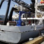
Researchers from NOAA, U.S. Geological Survey and their partners have completed the first high-resolution, comprehensive mapping of one of the fastest moving underwater tectonic faults in the world, located in southeastern Alaska.
| |
| |  | | TomTom Go Essential
The all new TomTom GO Essential is a powerful yet easy-to-use navigation device that seamlessly integrates with a smartphone. The built-in Wi-Fi® means that drivers no longer need to connect to a computer to get the latest maps and software updates.
| |
| |  | | Include Interactive Maps in WordPress Blogs
Web Maps for WordPress is an easy and affordable (how about free?) way to add professional looking maps to your blog posts. You don’t have to be a geographer or GIS pro to use this. If you happen to be one of those, you may really dig the Pro version, which allows you to connect your ArcGIS Online content with your WordPress blog.
| |
| |  | |
Ocean’ satellite Sentinel-6A beginning to take shape
The integration of Sentinel-6A, the first of two satellites to continue measuring sea levels from 2020, has reached a new milestone and its critical phase: the propulsion module has been “mated” with the main structure of the satellite at Airbus.
|
|
| |  | | USGIF Awards Highest Amount of Annual Scholarship Funds to Date
This is the largest annual amount USGIF has distributed to date, thanks to the contributions of USGIF Organizational Members committed to investing in GEOINTeducation. Since the USGIF Scholarship Program began in 2004, the Foundation has awarded more than $1.2 million to students with aspirations in GEOINT.
| |
| |  | | Topcon introduces new software for UAV inspection applications
Topcon Positioning Group announces new software designed to facilitate data processing workflow for UAV (unmanned aerial vehicle) infrastructure inspection — MAGNET Inspect. The software efficiently manages large UAV data sets to create inspection reports.
| |
| |  | | Around-the-Web - A Must for GIS Program Admins in K-12 and Higher Ed
Canada’s largest geomatics-focused learning institution uses several tools as part of their routine account clean-out. In just a few, simple steps, administrators can manage all the students and content in their program. This can make the start of a new semester much more streamlined and stress-free.
| |
| |









