| |  | | SimActive Introduces New Technology for True Orthos
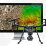
SimActive Inc., a world-leading developer of photogrammetry software, is pleased to announce Correlator3DT version 7.1 with revolutionary technology for true orthos. Users can now automatically generate enhanced true orthomosaics through a technological breakthrough that significantly minimizes artifacts.
| |
| |  | | Avenza Releases MAPublisher 10 For Adobe Illustrator
This MAPublisher release introduces the ability to manage data links where MAP layers in a document can be updated when its source data has been modified. "We've reached out for valuable user feedback since our last release and have heard many requests for improved GIS data management and streamlined import," said Ted Florence, President of Avenza.
| |
| |  | |
Global Mapper LiDAR Module v.19 Now Available with Photogrammetric Point Cloud Generation
Version 19 of this comprehensive point cloud processing utility introduces a powerful new tool for creating a 3D point cloud from an array of overlapping images. Ideally suited for Unmanned Aerial Vehicle (UAV) operators, this Pixels-to-PointsT tool effectively transforms simple drone-collected images into a 3D representation of a project area and provides the raw material for the Module's expansive classification, DEM creation, and feature extraction capabilities.
|
|
| |  | | Building a Unique GIS Website without Coding by Brand New SuperGIS Server 10
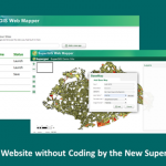
Supergeo empowers this next-generation SuperGIS Server with Web Mapper, the easy-to-use component to help developers customize their GIS website within few clicks. By checking few boxes and configuring desired widgets, instead of coding JavaScript, users only need few minutes to complete whole layout setting. Publishing and customizing GIS website could be much easier with Web Mapper.
| |
| |  | | Admin Tools for ArcGIS Online Supports Managing GIS Student Accounts at Center of Geographic Science
The GIS / Geotech EDU user community, in particular, higher learning, has been very active with Admin Tools for ArcGIS Online since the launch in 2015. In fact, the Geo EDU community is likely the most passionate and appreciative user base. To date, hundreds of High Schools, Colleges and Universities around the World have adopted Admin Tools to assist in managing GIS students and their ArcGIS Online accounts.
| |
| |






