| |  | | Pix4D Announces First User Conference in Denver, Colorado
Users are invited to share experiences about their work with drone mapping: for surveying, construction, agriculture, public safety, humanitarian purposes and more. Pix4D photogrammetry software has been used to map on every continent – including Antarctica. In 2018 alone, Pix4D’s 50,000 active users mapped more than 120 million acres.
| |
| | 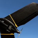 | | senseFly Introduces eBee X with MicaSense RedEdge-MX
The sensor that doesn’t compromise meets mapping without limits. New dual solution enables farming, agricultural science, forestry and environmental protection professionals to gain valuable multispectral crop insights more efficiently than with slower, smaller-coverage multirotor drones.
| |
| |  | |
Orbit GT releases version 19.3 of its 3D Mapping portfolio
“With version 19.3, our 3D Mapping portfolio again takes a huge leap forward”, says Peter Bonne, CEO of Orbit GT. “This new release has much more to offer than you would think at first look. Improvements in every product, and quite some eye-catchers as well. Available for download today ! ”
|
|
| |  | | GeoData Summit, this week in Virginia!
The 2019 GeoData Summit brings together members of the GIS community across Agriculture, Utilities, Transportation, Infrastructure, and Government for an open dialogue about how the current revolution in Geospatial technologies is transforming real-time decision-making through enhanced data collection.
| |
| |  | | Pivvot™ Releases Integra Link Route
Pivvot, a leading provider of infrastructure asset management solutions, is pleased to release the latest module in the Integra Link® platform, Integra Link | Route. Route analyzes engineering, environmental and socio-economic data to generate least-cost, minimal impact routes for pipelines and electric transmission corridors.
| |
| |  | | RFI – DARPA Seeks Tools to Capture Underground Worlds in 3D
The Defense Advanced Research Projects Agency (DARPA) are seeking ideas for state-of-the-art commercial products, software,
services and methodologies for advanced mapping and surveying in order to collect highly accurate and reproducible ground-truth data for subterranean environments. Responses to the RFI are due April 15.
| |
| |  | | SimActive Releases Version 8.1 with Advanced Editing Tools
SimActive Inc., a world-leading developer of photogrammetry software, announces the release of Correlator3D™ version 8.1 specifically addressing advanced needs from expert users. Added features include, among many improvements, new DEM editing capabilities.
| |
| |






