| |  | |
SimActive Launches New Drone Processing Service
SimActive Inc., a world-leading developer of photogrammetry software, announces a new drone data processing service based on Correlator3D™. Clients can now upload full projects and have SimActive experts generate optimal results from their imagery, including DSMs, DTMs, 3D models and orthomosaics.
|
|
| |  | | LIDARUSA Puts Safety First With Drone Rescue Systems
LiDARUSA is pleased to announce the option of the Drone Rescue Systems parachute system with all DJI M600 UAV sales. Any mapping equipped drone will have enough weight to potentially harm a person even if falling from a low altitude flight. The Drone Rescue system greatly mitigates this danger and gives the pilot added assurance that should the system fail, they have gone the extra mile to prevent harm to any by-standers.
| |
| |  | | Scan Dimension Releases Mac Version of Popular SOL 3D Scanner
Scan Dimension®, developer of 3D scanning, imaging, and realization technology, today announces the macOS version of its 3D desktop scanner, SOL. Scan Dimension’s SOL is the market’s most user-friendly 3D scanner, ideal for the engineer, maker, designer, or hobbyist. Now, customers can use SOL with macOS Mojave.
| |
| | 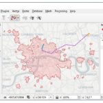 | | TravelTime platform releases QGIS plugin
TravelTime platform launches a new QGIS plugin that enables users to create travel time polygons, also known as isochrones, using many modes of transport. For example, a pizza restaurant owner can use the plugin to discover pizza delivery areas, such as where’s reachable within a 30-minute drive from their restaurant
| |
| |  | | MUST See Technology at the 2019 ESRIUC
The 2019 International Esri User Conference (#ESRIUC) takes place July 8-12, 2019 in beautiful San Diego, CA. We are pleased to feature updates and tips from some of the exhibiting companies (Esri partners). Below you’ll find details of some of their latest “Must See” technologies!
| |
| |











