| | 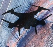 | | Direct Geopositioning in Drone Mapping
Direct geopositioning reduces or, in some cases, eliminates entirely, the need for ground control points in high accuracy aerial mapping. This complimentary whitepaper addresses accuracy, modeling from images, initial positional estimate, differential GNSS, cameras, various packages, post processing, how it all comes together and more.
| |
| |  | | Reality Capture.Scan with accuracy. Design with confidence
Capture the present and form the future with Reality Capture. Get your free eBook and learn more about the benefits of Reality Capture for your design and construction projects, including superior accuracy, efficiencies gained, starting designs in 3D and more. Autodeskr ReCapT offers a complete photogrammetry solution for accurate, 3D modeling of your as-built conditions.
| |
| |  | | Geo Industry Outlook, Trends to Watch in 2018
At year end we reached out to several GeoTech industry leaders for their opinion and they enthusiastically shared their thoughts, experience, and vision. Thanks to James Fee, Anthony Quartararo, and Geoff Zeiss for contributing their opinions and optimism for the industry. So, what do you think is going to be HOT in 2018?
| |
| |