| |
 |
|
5 More Solutions for Working With LiDAR
Building on a previous list, we now share 5 more tools that professionals working with, or having a need to work with, LiDAR data should consider. What is LiDAR? LiDAR technology uses waves typically in the visible, ultraviolet and infrared range. This technology enables direct measurement of 3D structures and underlying terrain with high resolution and high data accuracy
|
|
| |
 |
|
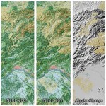
A Decade of Change in America's Arctic
The extensive NLCD database continues to add to our understanding of where land cover change has occurred across the Nation over time. Derived from carefully calibrated, long-term observations of Landsat satellites,
|
|
| |
 |
|
Canon announces the Oc‚ ColorWave 700 printing system
Canon announces the Oc‚ ColorWave 700 printing system - a productive workhorse for a wide range of color graphics applications - The versatile and productive printing solution for both graphics and technical application needs
|
|
| |
 |
|
EDU Tip - free 4 week MOOC offered by Elmhurst College
Elmhurst College's Skills for the Digital Earth MOOC (massive open online course) is a FREE, 4-week, online course designed to introduce how location technologies are used in society. Offered through Desire2Learn (D2L) Open Courses, the course will run from March 1 to March 28 (dates are subject to change).
|
|
|
|








