| |  | | Race for Precision: Achieving accurate positions in challenging conditions
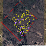
Carrying equipment is part of a field tech’s job. But with the introduction of software-defined GNSS receivers, that job may have gotten easier. Crews can now navigate woodland areas and rocky terrain carrying little more than a smartphone. Canadian GIS specialists tested this new technology while bushwhacking their way through a jungle-like site to chart a trail... (Sponsor Content)
| |
| |  | | Infographic – Coding Bootcamp vs. Computer Science Degree
Investing in the training necessary to write code professionally could be among the most secure career decisions a person can make for their future. So what’s keeping driven, capable individuals from this lucrative and in-demand profession? This infographic explores the topic a bit deeper.
| |
| |  | | USGIF Awards Highest Amount of Annual Scholarship Funds to Date
The United States Geospatial Intelligence Foundation (USGIF) recently awarded $126,000 in scholarships to individuals studying geospatial intelligence (GEOINT) and related topics. This is the largest annual amount USGIF has distributed to date, thanks to the contributions of USGIF Organizational Members.
| |
| |  | |
Social media provide critical information missed by FEMA
Social media sites can be a valuable tool for assessing the impact of natural disasters like Hurricane Harvey, but a new report indicates much of the critical information conveyed by those sites is overlooked by federal authorities. Rice University’s Kinder Institute for Urban Research reports that almost half of Hurricane Harvey damage reports provided by social media users were not captured by Federal Emergency Management Agency (FEMA) estimates.
|
|
| |  | | TomTom Reaches Mapping Milestone
TomTom today announced that, in a single month, it has made 1.5 billion changes to its digital maps which are delivered to TomTom customers on a weekly basis. The milestone is key to the company’s mission to shape the future of mobility in a world that increasingly relies on digital maps as an accurate representation of reality.
| |
| |  | | Satellites Capture Smoky Skies in North America
In mid-August 2018, deadly blazes across the western United States and Canada continued to destroy structures and disrupt the lives of millions of people. But you did not have to be close to the fires to witness its effects. These images show just how far across North America winds have carried the thick plumes of smoke.
| |
| |